
General purpose two-dimensional CAD program
A9CAD is a general purpose two-dimensional CAD program.

2D Drafting, 3D Modeling and BIM
ActCAD is a native DWG & DXF Software under which it offers three specific types of CAD Software namely – ActCAD Standard for 2D Drafting Power Users, ActCAD Professional for 2D Drafting and 3D Modeling and ActCAD BIM.
ArCADia is a program supporting 2D and 3D design. Due to its operational philosophy and the same data saving format (DWG), it closely resembles the Autocad program.
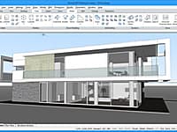
ArchiCAD is an architectural BIM CAD software for Macintosh and Windows developed by the Hungarian company Graphisoft.
CAD Design, Drafting, Modeling, Drawing and Engineering
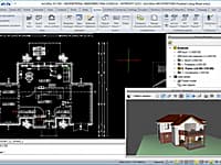
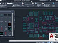
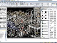
AutoCAD is a commercial software application for 2D and 3D computer-aided design, drafting, modeling, drawing, and engineering.
2D CAD software for drafting, detailing, and editing
For 2D drafting, AutoCAD LT delivers AutoCAD software’s 2D drawing tools at a cost-effective price.
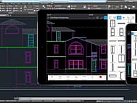
2D Drafting Tool on Mobile Devices
AutoCAD mobile is a DWG viewing application, with easy-to-use drawing and drafting tools that allow you to view, create, edit and export AutoCAD drawings on mobile devices.
Create 2D technical drawings and floor plans + 3D direct modeling operations with BricsCAD. BricsCAD is the familiar design platform for all your needs; 2D drafting, 3D modeling, mechanical design and BIM.
CAD editor and viewer (formerly ZWCAD Touch)
ZWCAD Touch is the 1st CAD (Computer-Aided Design) application that integrates 3rd-party Cloud Storage Service (like Dropbox and SkyDrive) internally.
CAD Standard 2D Computer Aided Design
CadStd is a general purpose, easy to learn CAD/drafting program for creating professional quality mechanical designs, house plans, blueprints, schematics and charts utilizing ANSI drawing standards.
CMS IntelliCAD Compatible CAD Software is the intelligent and affordable full-featured choice for engineers, architects and consultants, or anyone who communicates using CAD drawings.
Architecture, Engineering and Construction
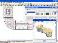
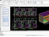
CYPECAD was brought about to carry out the analysis and design of reinforced concrete and steel structures, subject to horizontal and vertical forces, for houses, buildings and civil work projects.
Digitizing & Coordinate Conversion
Didger is a highly accurate digitizing program that will be an invaluable addition to your software library.
Accelerated Masonry Building Design
NCMAs Direct Design Software can reduce the time required to engineer many single-story masonry structures from days to just minutes.
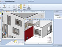
Domus. Cad is a program for architectural 3D design which allows you to face 3D design with the same simplicity as a traditional 2D design.
DraftSight is a professional-grade 2D design and drafting solution that lets you create, edit, view and markup any kind of 2D drawing.
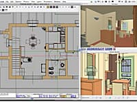
Edificius is the Architectural BIM Design software that allows you to generate floor plans, elevation views, cross-sections, isometric and perspective views with a simple 2D or 3D input.
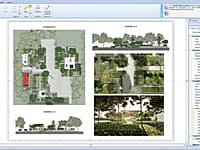
Edificius LAND is the BIM software for landscape architecture and garden design.
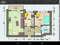
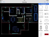
Create Detailed and Precise Floor Plans
Create detailed and precise floor plans. Add furniture to design interior of your home.
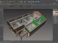
FreeCAD is a parametric 3D modeler. Parametric modeling allows you to easily modify your design by going back into your model history and changing its parameters.
You are on page 1 of 2

