Didger screenshot
SOFTWARE :Didger
DEVELOPER :Golden Software
VERSION :5
PLATFORM :Windows
FILE SIZE :80.14 MB
LICENSE :Demo
DOWNLOADS :UserDownloads:1070
Legacy Software Notice:
Please be advised that Didger is considered outdated or legacy, and it has reached the end of its support and update cycle. As a result, compatibility issues may arise, and its functionality cannot be guaranteed on modern computer systems.
Program Description

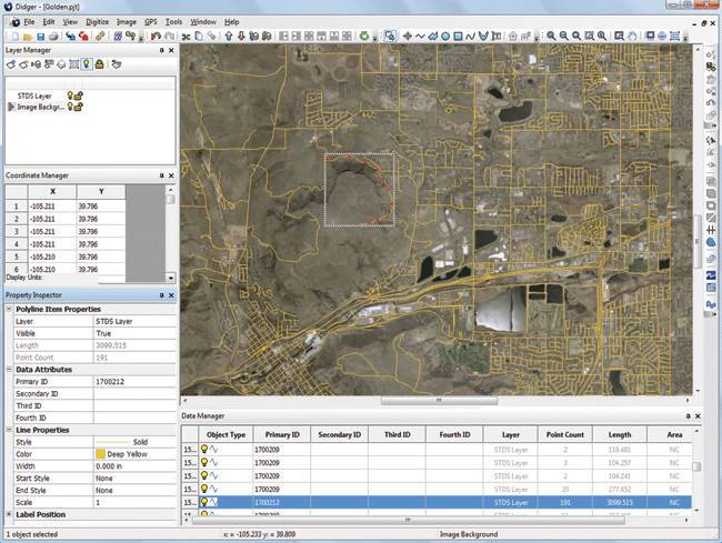
Didger is a highly accurate digitizing program that will be an invaluable addition to your software library. In seconds, Didger precisely transforms points, lines, or areas from your graphics, aerial photos, paper maps, imported vector files, scanned raster images or GeoTIFF photos to a versatile digital format you can use with your other software.  

By Didger you can

  • Digitize a vector or raster project onscreen.
  • Digitize directly into a vector project using a GPS unit.
  • Display all the raw data being sent form the GPS unit or save it to a data or text file.
  • Average the data from the GPS over x number of sample points.
  • See the current position of the satellites that are being used for a lock for the GPS.
  • Display all GPS displays and settings.
  • View the current elevation with the GPS unit.
  • Thin and smooth objects by selecting point selection removal, deviation distance, vertex averaging, or spline smoothing options.
  • Reshape objects by adjusting individual nodes.
  • Combine, split, and/or reverse islands and lakes.
  • Merge two polygons together, or create a polygon from the intersection of two polygons.

* Didger download link provides demo version of the software.

Similar Software
Grapher Version:17.2 · Golden Software
Grapher

2D & 3D Graphing

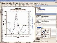
Grapher is the only graphing program you will ever need. Create powerful stunning graphs quickly and efficiently. Ideal for scientists, engineers, and business professionals.

Strater Version:5.7 · Golden Software
Strater

Well Log & Borehole Plotting

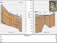
Strater is a powerful and innovative well log, borehole and cross section plotting software package for geoscientists.

Surfer Version:20.1 · Golden Software
Surfer

Contouring & Surface Mapping

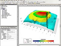
Golden Softwares Surfer software is a full-function 3D visualization, contouring and surface modeling package that runs under Microsoft Windows.

MapViewer Version:8 · Golden Software
MapViewer

Thematic Maps & Spatial Analysis

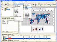
MapViewer is an affordable mapping and spatial analysis tool that allows you to easily produce publication-quality thematic maps

Voxler Version:4.6 · Golden Software
Voxler

3D Well Data and Modeling

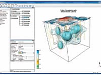
Create powerful, fast, customized 3D images of your data with Voxler 2.

Comments & Reviews

No comments yet. Be the first to comment.

Submit a review about Didger software with your social media profile

avatar
Rate This Software

Didger has been rated 1.0 out of 5 points. A total of 1 votes cast and 0 users reviewed the software.

Popular Programs

3898 hitsA9CAD 2.2.1

A9CAD is a general purpose two-dimensional CAD program.

2787 hitsAdvance Steel 2021

Advance Steel is specifically designed for structural engineers and steel detailers who require professional and easy-to-use BIM structural steel detailing software that automates the production of drawings, BOMs and NC files.

2503 hitsArchiCAD 23

ArchiCAD is an architectural BIM CAD software for Macintosh and Windows developed by the Hungarian company Graphisoft.

2348 hitsCypeCAD 2021.b

CYPECAD was brought about to carry out the analysis and design of reinforced concrete and steel structures, subject to horizontal and vertical forces, for houses, buildings and civil work projects.

New & Updated

27 AugSAPFIR-3D 2021

SAPFIR-3D is a software for architectural design of multi-storey residential and public buildings, structures of any purpose, small structures, cottages, concept of interior design.

30 JulActCAD 2023

ActCAD is a native DWG & DXF Software under which it offers three specific types of CAD Software namely – ActCAD Standard for 2D Drafting Power Users, ActCAD Professional for 2D Drafting and 3D Modeling and ActCAD BIM.

22 MayTrueCAD 2021

TrueCAD is a 2D Drafting and 3D Modeling (Partial) CAD software meant for Engineers, Architects and other technical consultants.

29 JanEdificius LAND BIM 2(m)

Edificius LAND is the BIM software for landscape architecture and garden design.