Graphical User Interface for MODFLOW, MT3DMS, SUTRA, PHAST, MODPATH, and ZONEBUDGET
ModelMuse is a graphical user interface for MODFLOW-2005, MODFLOW-LGR, MODFLOW-LGR2, MODFLOW-NWT, MODFLOW-CFP, MT3DMS, SUTRA, PHAST, MODPATH, and ZONEBUDGET
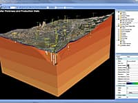
MODFLOW is considered an international standard for simulating and predicting groundwater conditions and groundwater/surface-water interactions.
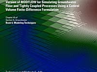
An Unstructured Grid Version of MODFLOW
An unstructured grid version of modflow for simulating groundwater flow and tightly coupled processes using a control volume finite-difference formulation
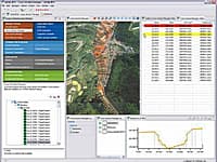
Nature Oriented Flood Damage Prevention, Information and Decision Support System
The nofdp IDSS (Nature Oriented Flood Damage Prevention, Information and Decision Support System) is an open source application for the interactive development of flood risk strategies and 1D hydrodynamic flood simulation.
TELEMAC-MASCARET is a set of computational fluid dynamics modules dedicated to free surface flows and groundwater flows.
Processing Modflow version 5. 3 is included in the first edition of the book 3D-Groundwater Modeling with PMWIN published by Springer-Verlag.
Processing Modflow (PMWIN) is a comprehensive integrated groundwater modeling system that is used by many organizations, such as research institutions, consulting firms, agencies, and entities of the United Nations.
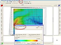
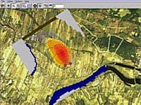
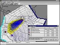
Visualization of Field Measurement Data and Groundwater Model Results
Seer3D is an application for the visualization of field measurement data and the groundwater model results. It includes powerful tools for displaying vector and raster maps, presenting wells, boreholes, lithological, and geophysical data.
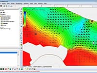
SMS (Surface-water Modeling System) is a complete program for building and simulating surface water models from Aquaveo.
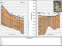
Strater is a powerful and innovative well log, borehole and cross section plotting software package for geoscientists.
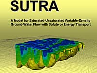
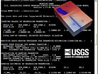
Model for Saturated-Unsaturated, Variable-Density Ground-Water Flow with Solute or Energy Transport
A model for 2D or 3D saturated-unsaturated, variable-density ground-water flow with solute or energy transport.
WATER9, the wastewater treatment model, is a Windows based computer program and consists of analytical expressions for estimating air emissions of individual waste constituents in wastewater collection, storage, treatment, and disposal facilities; a datab
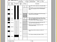
Soil boring logs and well construction diagrams
Well Logger software lets you create soil boring logs and well construction diagrams.
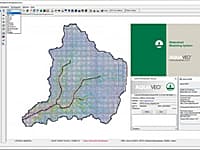
The All-in-one Watershed Modeling System
Aquaveo WMS (Watershed Modeling System) is a watershed computer simulation and modeling software application from Aquaveo. WMS is a all-in-one hydrologic and hydraulic solutions and pipe network tools.
You are on page 2 of 2
« First 2


