
Autodesk is a world leader in 3D design software for entertainment, natural resources, manufacturing, engineering, construction, and civil infrastructure.
CESDb currently lists 4 software developed by Autodesk Inc., including AutoCAD, Autodesk Viewer, AutoCAD Mobile, AutoCAD LT.
You can also visit developers official website http://autodesk.com for software support, product updates, licenses and other information.
CAD Design, Drafting, Modeling, Drawing and Engineering
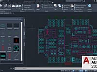
AutoCAD is a commercial software application for 2D and 3D computer-aided design, drafting, modeling, drawing, and engineering.
2D CAD software for drafting, detailing, and editing
For 2D drafting, AutoCAD LT delivers AutoCAD software’s 2D drawing tools at a cost-effective price.
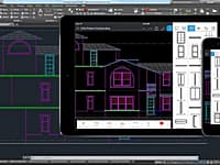
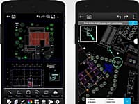
2D Drafting Tool on Mobile Devices
AutoCAD mobile is a DWG viewing application, with easy-to-use drawing and drafting tools that allow you to view, create, edit and export AutoCAD drawings on mobile devices.

Online Viewer for 2D and 3D Designs
Autodesk Viewer is a free online viewer for 2D and 3D designs including AutoCAD DWG, DXF, Revit RVT and Inventor IPT, as well as STEP, SolidWorks, CATIA and others.
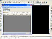
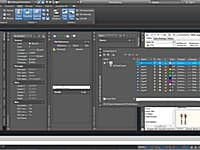
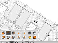
Create Digital Elevation Model from AutoCAD
AEC Terrain is designed to simplify terrain management and 3D-modeling.

Civil Infrastructure Design Suite
Civil Designer software gives you an integrated civil infrastructure design suite of modules incorporating bulk earthworks, highways, roads, surface drainage, wastewater drainage and potable pressurized water network design and analysis, in a single application.
DWG FastView is a cross-platform CAD software that meets designers demands in all kinds of situation, and fully compatible with AutoCAD.
ETOOLBOX Free CAD Viewer is a mobile CAD application (*. dwg) viewer of the CMS IntelliCAD® CAD Software or any CAD software able to create *. dwg, *. dxf and *. dwf files.
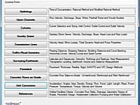
Civil Engineering Calculations
Performs civil engineering calculations for hydrology, open channels, culverts, gravity sewer, transmission lines, traffic/road geometry, surveying/earthwork, pavement, concrete floors and unit conversions.
