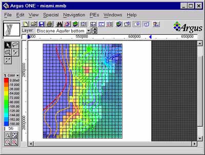
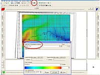
Argus ONE is a family of general purpose graphical Pre- and Post-Processors for the numerical modeler. The Argus Open Numerical Environments (Argus ONE) enable you to easily and intuitively prepare your data for any modeling package, finite element as well as finite difference based. By automatically linking the physical data you enter in GIS layers to grid blocks or mesh nodes and elements, Argus ONE keeps your data reusable. Changing your mesh or grid doesn't require you to re-enter your data. It represent a whole new approach of combining GIS and numerical modeling. Argus ONE is used in three forms:
- A generic environment for numerical modelers - Enabling the modeler to prepare and send data to any numerical model.
- A specific integrated application - Using models which have been fully integrated with Argus ONE as PIEs.
- An application development environment - Enabling model developers to create Graphical User Interfaces for their models.
Argus ONE is widely used by engineers, in the following fields:
- Ground water modelers
- Surface flow modelers
- Environmental Development
- Petroleum reservoir engineers
- Oceanographical physicists
- Coastal and marine engineers
- Civil engineers
- Mineral mining engineers
Some models are available as fully integrated Plug-In Extensions (PIEs) for Argus ONE: MODFLOW/MOC3D, HST3D, SUTRA, NAPL, LandUse Analyst, PTC
* Argus ONE download link provides trial version of the software.
Graphical User Interface for MODFLOW, MT3DMS, SUTRA, PHAST, MODPATH, and ZONEBUDGET
ModelMuse is a graphical user interface for MODFLOW-2005, MODFLOW-LGR, MODFLOW-LGR2, MODFLOW-NWT, MODFLOW-CFP, MT3DMS, SUTRA, PHAST, MODPATH, and ZONEBUDGET
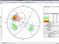
Graphical and Statistical Analysis of Orientation Data
Dips is designed for the interactive analysis of orientation based geological data.
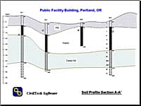
Boring Log and Test Pit Graphical Reports
SuperLog generates boring log and test pit graphical reports for field drilling and geotechnical investigations. It is a user-friendly, easy to learn, powerful, and flexible program, which will increase your productivity significantly.

Open Source Numerical Computing Environment
FreeMat is a free open source numerical computing environment and programming language, similar to MATLAB and GNU Octave.
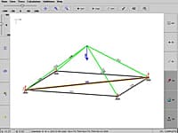
Fachwerk3D is the spatial version of the program Fachwerk. It intends to simplify the application of discontinuous stress fields and strut-and-tie models.
Submit a review about Argus ONE software with your social media profile
No comments yet. Be the first to comment.