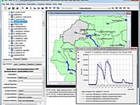
WMS is a comprehensive environment for hydrologic analysis. It was developed by the Enironmental Modeling Research Laboratory of Brigham Young Universityin cooperation with the U.S. Army Corps of Engineers Waterways Experiment Station and is currently being developed by Aquaveo LLC.
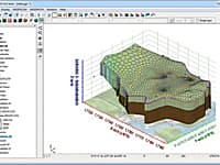
WMS offers state of the art tools to perform automated basin delineation and to compute important basin parameters such as area, slope and runoff distances. It also serves as a graphical user interface for several hydraulic and hydrologic models. With its management of coordinate systems, WMS is capable of displaying and overlaying data in real world coordinates. The program also provides many display tools for viewing terrain surfaces and exporting images for reports and presentations.
The complete all-in-one watershed solution
- GIS Tools
- Web-based data acquisition tools
- Terrain data import and editing tools
- Automated watershed delineation & hydrologic modeling
- Support for the most industry standard hydrologic models
- Step-by-step hydrologic modeling wizard
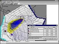
- Hydraulic modeling & floodplain mapping
- Storm drain modeling
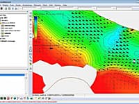
- 2D (Distributed) Hydrology
- Integration with FHWA hydraulic calculation software
- Export WMS animations to GoogleTM Earth
Automated watershed delineation & hydrologic modeling
- Automatically delineate a watershed and sub-basins using digital terrain data
- Automatically compute geometric basin data such as area, slope, mean elevation, maximum flow distance and more
- With a small amount of input, compute hydrologic basin data such as time of concentration, curve number, and infiltration parameters
- Industry standard equations for computing sub-basin lag times and times of concentration are included with WMS
- Add any number of interior outlet points and let WMS subdivide the watershed automatically
- Manipulate stream networks to represent man-made features or proposed changes to the watershed
- Override derived basin boundaries to match your knowledge of the watershed
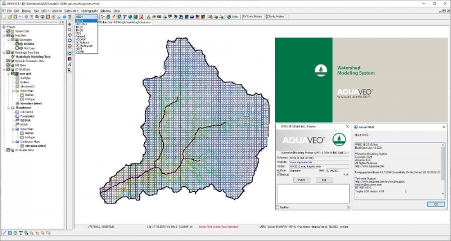
Support for most industry standard hydrologic models
- HEC-1
- HEC-HMS
- TR-20
- TR-55
- Rational Method
- MODRAT
- OC (Orange County, California) Rational
- OC Hydrographic
- HSPF
- National Streamflow Statistics
- Convert and compare the results of a watershed developed for one model with any of the other models supported in WMS
- Read and compare observed hydrographs with computed hydrographs
Hydraulic modeling & floodplain mapping
- Define a stream centerline and bank stations
- Define cross section locations
- Automatically cut cross sections and derive Manning's roughness values from elevation and ground material data
- Export cross sections to the HEC-RAS or Simplified Dam Break hydraulic models
- Run the hydraulic model and read the water elevations back into WMS
- Read water surface elevation data from a hydraulic model or manually input known water surface elevations
- Create flood extents and flood depth maps using digital terrain data and water surface elevation data points
- Link the peak flow or complete hydrograph from any of the WMS-supported hydrologic models to an HEC-RAS hydraulic model
Storm drain modeling
- Draw a storm drain network or import a network from GIS
- Compute elevations, lengths, and slopes of pipes from underlying elevation data
- Link the storm drain network to your hydrologic model data
- Export the hydrologic model data and the storm drain network to EPA-SWMM or XP-SWMM
- Import existing EPA-SWMM or XP-SWMM files into WMS
* WMS download link provides trial version of the software.
GMS (Groundwater Modeling System) is water modeling application for building and simulating groundwater models from Aquaveo.
SMS (Surface-water Modeling System) is a complete program for building and simulating surface water models from Aquaveo.
Processing Modflow (PMWIN) is a comprehensive integrated groundwater modeling system that is used by many organizations, such as research institutions, consulting firms, agencies, and entities of the United Nations.
The Hydrologic Modeling System (HEC-HMS) is designed to simulate the complete hydrologic processes of dendritic watershed systems.
Visualize, Reference, Analyze Water Distribution Networks
Online web application for visualizing, referencing, and analyzing water distribution models.
Submit a review about WMS software with your social media profile
No comments yet. Be the first to comment.