CESDb > General Tools > MapViewer
MapViewer screenshot
SOFTWARE :MapViewer
DEVELOPER :Golden Software
VERSION :8
PLATFORM :Windows
FILE SIZE :87.3 MB
LICENSE :Demo
DOWNLOADS :UserDownloads:434
Legacy Software Notice:
Please be advised that MapViewer is considered outdated or legacy, and it has reached the end of its support and update cycle. As a result, compatibility issues may arise, and its functionality cannot be guaranteed on modern computer systems.
Program Description

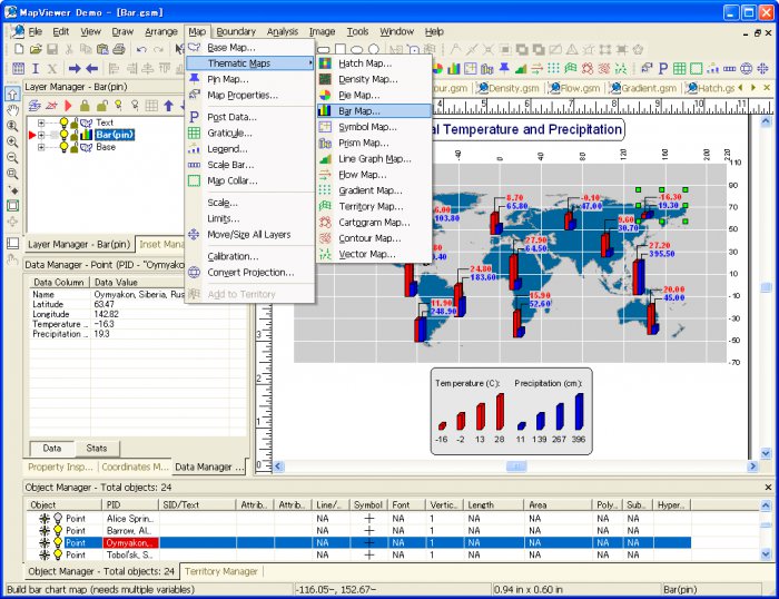
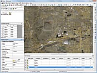
MapViewer is an affordable mapping and spatial analysis tool that allows you to easily produce publication-quality thematic maps. Precisely display your data distribution with the most intuitive functions and features. Your data is unique and you need the best mapping software for the job!

Create one of 15 different 2D and 3D map types including: contour, density, prism, flow, territory, vector, gradient and many more!

  • Visually display your information for a better understanding of data
  • Customize maps to create or define sales, insurance, and marketing territories
  • Use customized maps to outline marketing strategies
  • Use maps to compare data to track trends
  • Effectively display distribution of any geographically distributed data
  • Create a variety of presentation quality images to geographically display information

* MapViewer download link provides demo version of the software.

Similar Software
Grapher Version:17.2 · Golden Software
Grapher

2D & 3D Graphing

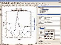
Grapher is the only graphing program you will ever need. Create powerful stunning graphs quickly and efficiently. Ideal for scientists, engineers, and business professionals.

Surfer Version:20.1 · Golden Software
Surfer

Contouring & Surface Mapping

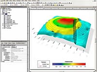
Golden Softwares Surfer software is a full-function 3D visualization, contouring and surface modeling package that runs under Microsoft Windows.

Strater Version:5.7 · Golden Software
Strater

Well Log & Borehole Plotting

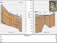
Strater is a powerful and innovative well log, borehole and cross section plotting software package for geoscientists.

Didger Version:5 · Golden Software
Didger

Digitizing & Coordinate Conversion

Didger is a highly accurate digitizing program that will be an invaluable addition to your software library.

Voxler Version:4.6 · Golden Software
Voxler

3D Well Data and Modeling

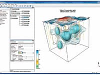
Create powerful, fast, customized 3D images of your data with Voxler 2.

Comments & Reviews

No comments yet. Be the first to comment.

Submit a review about MapViewer software with your social media profile

avatar
Rate This Software

No one has rated MapViewer yet. Be the first to rate this product.

Popular Programs

5799 hitsGeoRose 0.5.1

GeoRose is a program plotting rose diagram used in structural geology area.

3210 hitsCalcPad 6.1.4

CalcPad is a professional software for mathematical and engineering calculations. It represents a flexible and modern programmable calculator.

3009 hitsA9Convert 1.0.4

A9Convert is a command line program to convert DWG/DXF to different versions of DWG/DXF.

2918 hitsEngineering Libraries 1.29

Civil / Structural engineering app that bundles information for the construction industry.

New & Updated

6 DecMaple Flow 2023

Maple Flow makes it easy for engineers to brainstorm, develop, and document their design calculations. Maple Flow offers tools across the entire spectrum of math, science and engineering.

10 SepSMath Studio 0.99

SMath Studio is a tiny, powerful, free mathematical program with WYSIWYG editor and complete units of measurements support.

25 JunDWG FastView for Web 2020

Open your CAD drawings in all major browsers with the latest DWG FastView online version, no installation or upgrade needed.

4 JunDuometrix 2.0

Duometrix is a set of two programs - an Excel Add-in and a Windows Standalone - that convert units for students, scientists and engineers.