CESDb > Geotechnical Engineering > Geotechnical Graphics
Geotechnical Graphics screenshot
SOFTWARE :Geotechnical Graphics
DEVELOPER :M-Tech Software
VERSION :2014.12
PLATFORM :Windows
FILE SIZE :9.07 MB
LICENSE :Demo
DOWNLOADS :UserDownloads:662
Program Description

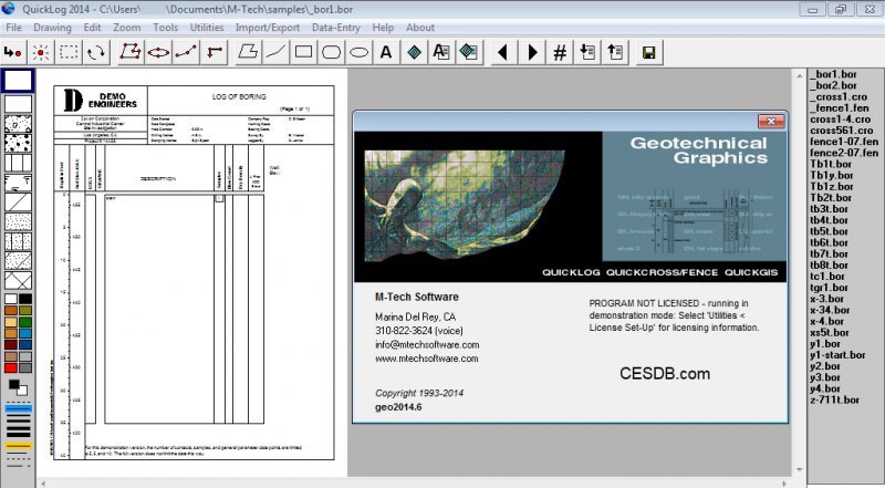
The four modules, QuickLog, QuickCross/Fence, QuickGIS, and QuickSoil are contained in one integrated application called "Geotechnical Graphics, " or "GeoGraphics" for short.

QuickLog

QuickLog greatly speeds and simplifies the process of creating boring log/well construction diagrams. Featuring a point and click graphical interface, it's intended for use by geologists or data entry staff members to create diagrams without the need for a CAD system. Hundreds of different formats can be created without programming or lengthy formatting.

QuickCross/Fence

The QuickCross and QuickFence modules use data already entered in QuickLog to create 2-D cross sections and 3-D fence diagrams. Using the drawing tools, you can edit the drawings right on the preview screen.

QuickGIS - QuickSoil

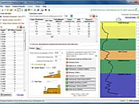
QuickGIS enables you to organize the lithology data for a set of borings into a table of X, Y, Z coordinates so that it fits the formats needed for exporting to most 3-D modeling programs such as ArcView and EVS. QuickSoil produces a soil analysis table that shows soil sample test purple supras for girls results for a set of parameters. Each sample is placed at its correct depth and shaded according to the value of each parameter tested. It makes it easy to see the areas of contamination throughout the different layers of soil.

After installation, all four modules in Geotechnical Graphics run in "demo" mode. However, after you have made a purchase, you will receive a password which will unlock the modules you've chosen. In summary: whether you are an owner or you are just trying the demo, you download the same file -- a password entered after installation controls which modules run in full mode.

* Geotechnical Graphics download link provides demo version of the software.

Similar Software
NovoFormula Version:2.0 · Novo Tech Software
NovoFormula

Geotechnical Correlations

Geotechnical engineers can use this software for day-to-day analysis and calculations.

Peysanj Version:5.2 · Novo Tech Software
Peysanj

Bearing Capacity

Peysanj is a series of geotechnical engineering modules such as bearing capacity and settlement, pressure-meter test, plate loading test, soil liquefaction analysis, etc bundled as single software.

NovoBPT Version:2.0 · Novo Tech Software
NovoBPT

Becker Penetration Test

NovoBPT is designed for correcting raw BPT blow counts (Nb) and converting them to SPT blow counts (N60).

LateralK Version:4.0 · Novo Tech Software
LateralK

Earth Pressure Analysis

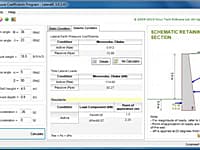
LateralK is a simple software for calculating lateral earth pressure coefficients and forces behind retaining walls in static and earthquake condition based on Rankine/ Coulumb formulas and also Mononobe/ Okabe methods.

NovoLiq Version:4.0 · Novo Tech Software
NovoLiq

Soil Liquefaction Analysis

This robust software is designed for soil liquefaction analysis during earthquake and supports multi-layer as well as single layer stratigraphy.

Comments & Reviews

No comments yet. Be the first to comment.

Submit a review about Geotechnical Graphics software with your social media profile

avatar
Rate This Software

Geotechnical Graphics has been rated 3.0 out of 5 points. A total of 2 votes cast and 0 users reviewed the software.

Popular Programs

13954 hitsPOLEFDN 2.3

POLEFDN is a spreadsheet program written in MS-Excel for the purpose of analysis of a pole foundation assuming the use of a rigid round pier which is assumed free at the top and subjected to lateral and vertical loads.

7806 hitsAllPile 7.19

AllPile is a Windows-based analysis program that handles virtually all types of piles, including steel pipes, H-piles, pre-cast concrete piles, auger-cast piles, drilled shafts, timber piles, jetted piles, tapered piles, piers with bell, micropiles (minipiles), uplift anchors, uplift plate, and shallow foundations.

7588 hitsDips 8.0

Dips is designed for the interactive analysis of orientation based geological data.

6918 hitsSlide 9.0

Slide is the most comprehensive slope stability analysis software available, complete with finite element groundwater seepage analysis, rapid drawdown, sensitivity and probabilistic analysis and support design.

New & Updated

14 JanRetainX 2022

Free retaining wall design software that fully works in a web browser. Create a stable retaining wall design using state-of-the-art software without downloading software.

13 JanDartis SPT Correlations 1.1.0

Dartis SPT is a powerful, user-friendly software for correlating soil properties from SPT blow counts. We have gone through many papers and geotechnical reference books and collected over 200 SPT correlations with various soil properties.

25 NovGaeaSynergy 4.0

GaeaSynergy is an application suite for geoscientific analyses, mapping, data display and data management. The program can be used to evaluate contaminants, soil and rock properties, mineral deposits, and oil and gas deposits.

18 NovWinLog 4.0

The WinLoG extension module of GaeaSynergy can be used to quickly and easily create, edit and print boring logs, borehole logs and well logs for a variety of industries.